Warning: file_get_contents(?v=1&t=pageview&dl=https%3A%2F%2Fkiwifoto.com%2Fblog%2Ftag%2Fsedona%2F&ul=en&de=UTF-8&dt=sedona+%26%238211%3B+kiwifoto.com&cid=18b52302-2db-eb5-2d3-2672c0d15d03948&uid=1649481958&tid=UA-8159714-1&ds=wp-seo-ga&a=4302261&z=902565&cd1=CCBot&cd2=Spider&cd3=Desktop&cd4=CCBot%2F2.0+%28https%3A%2F%2Fcommoncrawl.org%2Ffaq%2F%29&cd5=200&cd6=18b52302-2db-eb5-2d3-2672c0d15d03948&cd7=1649481958&cd8=54&cd9=0.782&cd10=181&cd11=CCBot&cd12=Spider&cd13=Desktop&cd14=https&cd15=HTTP%2F1.0&cd16=amazonaws.com): failed to open stream: File name too long in /usr/local/apache2/htdocs/kiwifoto/blog/wp-content/plugins/wp-seo-ga-master/wp-seo-ga.php on line 173
sedona | kiwifoto.com
RSS

Tag Archives: sedona

Thanksgiving Road Trip

Just returned from a ~2,000 mile road trip that took us from the Salton Sea in California to Sedona, Arizona and up to Page, Arizona to visit the infamous Upper Antelope Canyon and Horseshoe Bend.
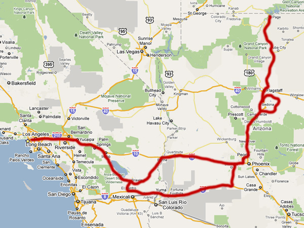
Trip Route
Trip Route

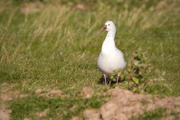
We started off at the Sea searching again for the Bean Goose in vain. I did get some more nice photos of Sandhill Cranes, Snow Geese and Ross’s Geese as their numbers continue to increase exponentially each day as more and more of them are coming in to winter in the fields.
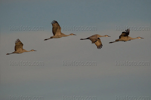
Sandhill Crane
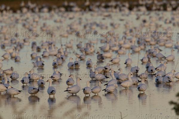
Sandhill Crane

Snow Goose
Snow Goose

We also found numerous (1st cycle) Glaucous-winged Gulls around the sea. Didn’t find any Lesser Black-backed Gulls so I’d say the GWGU was probably the most interesting Gull in the area.
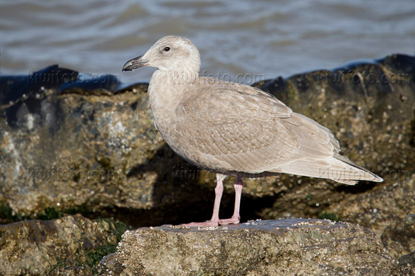
Glaucous-winged Gull

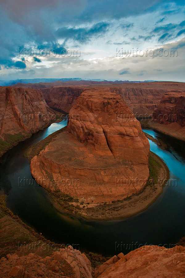
We left and continued our way toward Sedona in the early afternoon and arrived just before dusk. The following morning we woke up at 3AM to make the 200 mile trek north to Page, Arizona to photograph the world renowned Horseshoe Bend. This canyon was formed by the Colorado River and marks the start of The Grand Canyon. When we arrived it was just over 30F and starting to snow. I was hoping the skies would part just slightly to allow for a nice sunrise shot but it stayed overcast all morning.

Horseshoe Bend
Horseshoe Bend

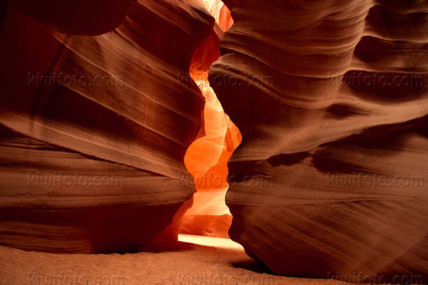
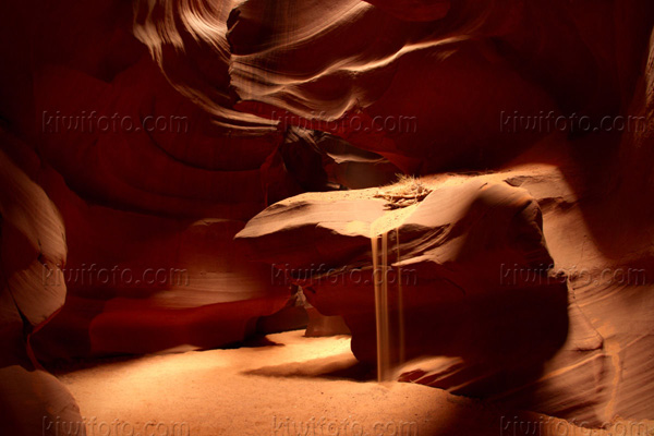
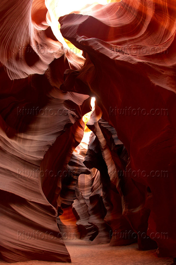
We headed back into town (Page, Arizona) to warm up and have some breakfast while we waited for our 10AM tour of Upper Antelope Canyon. Since Upper and Lower Antelope Canyon all reside on the Navajo Reservation, they require that you make reservations to visit this sacred land with a guide. The Navajo name for Upper Antelope Canyon is Tsé bighánílíní, which means “the place where water runs through rocks.” Lower Antelope Canyon is called, Hazdistazí. Antelope Canyon was formed by erosion of Navajo Sandstone, primarily due to flash flooding and secondarily due to other sub-aerial processes. Rainwater, especially during monsoon season, runs into the extensive basin above the slot canyon sections, picking up speed and sand as it rushes into the narrow passageways. Over time the passageways are eroded away, making the corridors deeper and smoothing hard edges in such a way as to form characteristic ‘flowing’ shapes in the rock.

Upper Antelope Canyon

Upper Antelope Canyon

Upper Antelope Canyon

Although this wasn’t the best time to photograph the canyon – summertime is the best when the sun reaches it’s peak and a “ray of light” can be photographed as it shines through the fissures above – it was still a beautiful and remarkable place. It’s no surprise that this was a place of spiritual enlightenment to the Navajo.

On the way back to Sedona we stopped at Wupatki National Monument to try and find some Abert’s Squirrels. We didn’t find any but a playful Steller’s Jay came to visit.
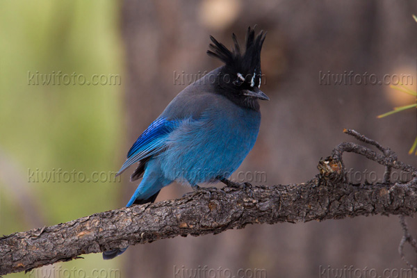
Steller's Jay
Steller’s Jay

A scenic drive around the Lake Mary and Mormon Loop, just southeast of Flagstaff, yielded a flock of over 75 Pinyon Jays!
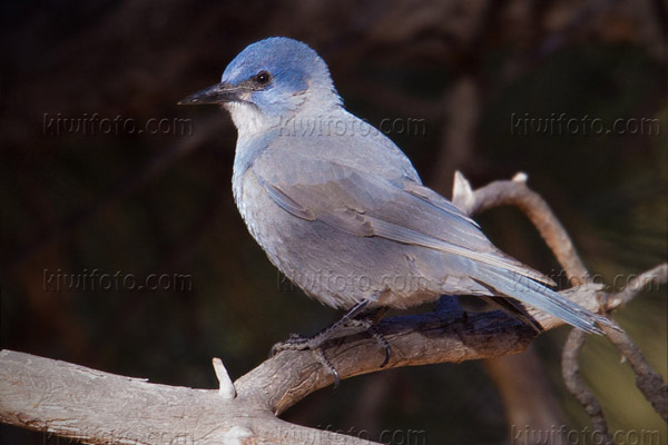
Pinyon Jay
Pinyon Jay

We spent Thanksgiving Day with Sara’s family in Sedona – they own a condo unit there – and did some sightseeing in the area. Temperatures dipped into the low 30’s while we were there. It lightly snowed but didn’t stick on the ground for long. On our drive home we took an alternate route down the I-8 through Gila Bend and stopped in Yuma County along the way to find a juvenile Streak-backed Oriole that Paul Lehman had discovered the day before.
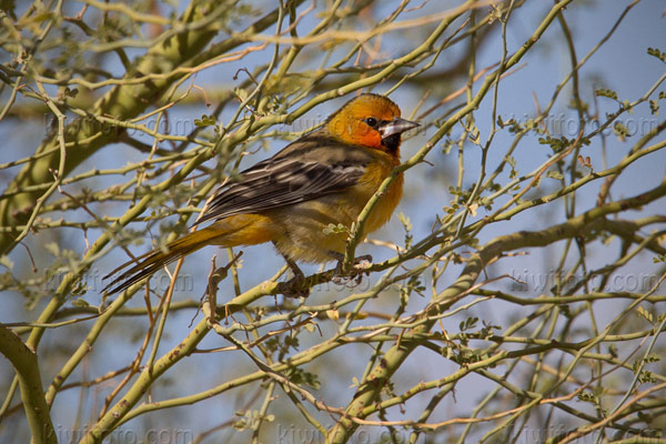
Streak-backed Oriole

It had found it’s way up from Sonora, Mexico to just about the only yard in the entire Yuma County that had lush trees and vegetation. We waited over two hours before the Oriole finally presented itself to feed- most likely due to the high winds.

While we were waiting I was able to get smashing photos of Crissal and Curve-billed Thrasher that were actively foraging on the ground. The car works as such a great blind!
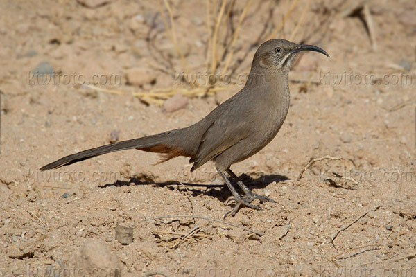
Crissal Thrasher
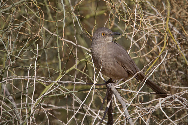
Crissal Thrasher

Curve-billed Thrasher

We stopped at the Salton Sea one more time on the way home and missed the Bean Goose once again! I’m one for three now…I am just thankful I was able to obtain good photos and documentation the day after it was discovered, earlier this month.

Again, I was able to get some MORE photos of Snow and Ross’ Geese – along with Sandhill Cranes – as if I didn’t have enough already! The afternoon sunset was beautiful though and the cranes against the yellow sky of the setting sky turned out nicely.
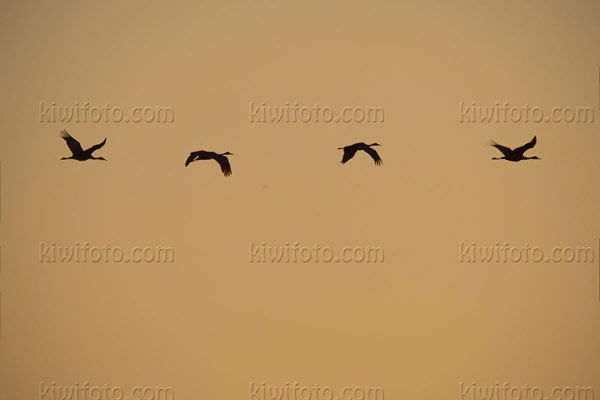
Sandhill Crane
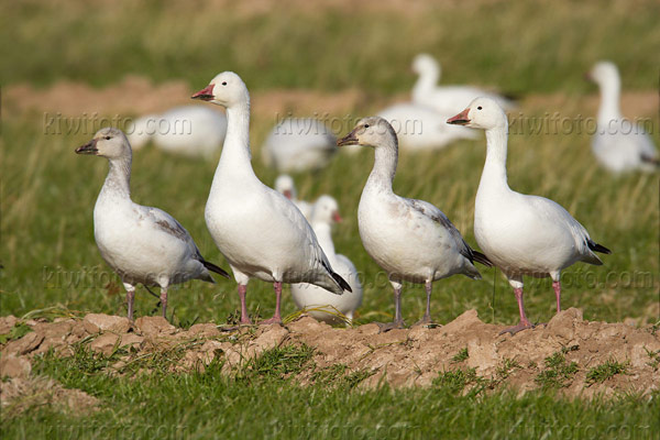
Sandhill Crane

Snow Goose
Snow Goose

Ross's Goose
Ross’s Goose

A very cooperative male Belted Kingfisher allowed for close approach and some nice photos. I was hoping it would fly over and land on a more “natural” setting – like a tree branch? But it seemed to prefer the telephone line!
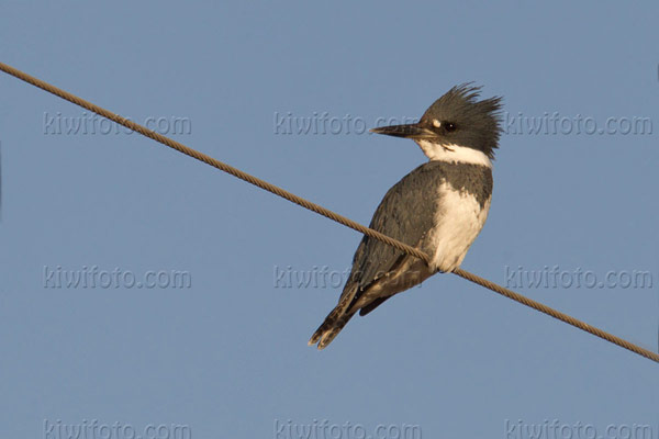
Belted Kingfisher
Belted Kingfisher

That’s all for now. We are off to Portland, Oregon on Friday!
 

Posted by on November 30, 2010 in Photography Adventures

1 Comment

Tags: , , , , , ,

Sedona and Navajo Nation

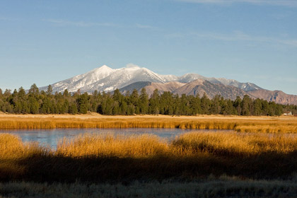
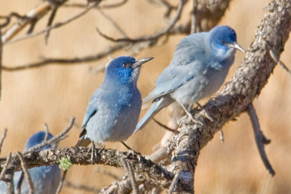
We spent half of Thanksgiving weekend in Sedona, AZ and the rest traveling through Navajo Nation to Canyon De Chelly National Monument – located just a few miles east of Chinle, AZ. I finally managed to photograph one of my many nemesis birds, Pinyon Jay. We located a flock of 45-50 of them near Upper Lake Mary which is approximately 25 mi. southeast of Flagstaff, AZ. Beautiful early-morning views of the San Francisco Mtns as well:

San Francisco Mtns.
San Francisco Mtns.

Pinyon Jay
Pinyon Jay

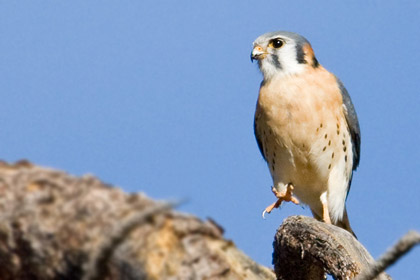
On the way back to Sedona, we took a bit of a detour through Prescott where I located a photogenic American Kestrel:


American Kestrel
American Kestrel

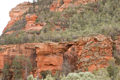
Later on in the day we drove out to some of the “vortex” areas but due to the quickly fading daylight we only had time to hike up to one of the scenic areas, Devil’s Bridge:

Devil's Bridge - Sedona, AZ
Devil’s Bridge – Sedona, AZ

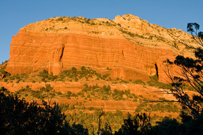
Sedona, AZ
Sedona, AZ

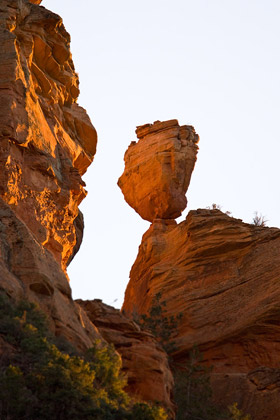
Balancing Rock - Sedona, AZ
Balancing Rock – Sedona, AZ

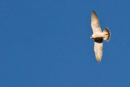
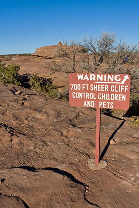
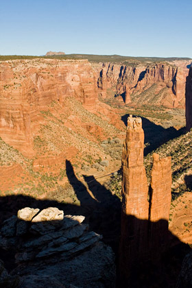
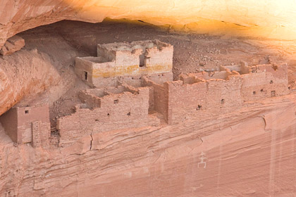
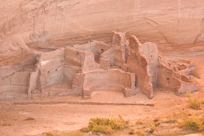
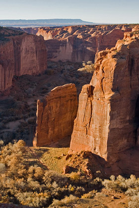
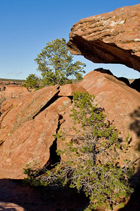
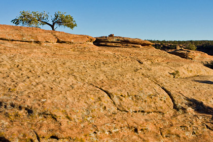
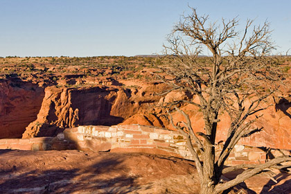
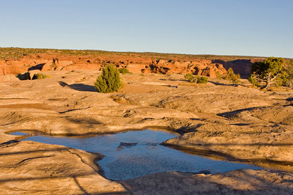
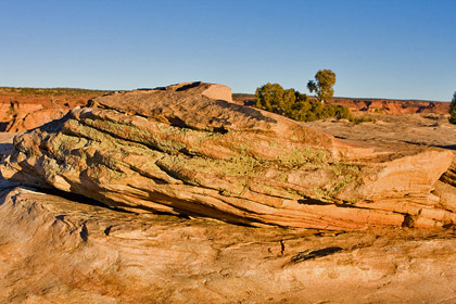
Sunday morning we left Sedona for Canyon De Chelly Natl. Monument – about a four hour drive NE of Sedona, AZ. We drove through much of the beautiful Navajo Nation land and arrived just before dusk. We hurried along the Southern Rim of the Canyon where the afternoon sun cast magnificent shadows amidst the spires of rock and Anasazi ruins. Just as we were leaving one of the vistas, Sara noticed a Peregrine Falcon performing aerial acrobatics some 2,500′ above the Whitehouse Ruins at the bottom of the canyon.

Peregrine Falcon
Peregrine Falcon

Canyon De Chelly
Canyon De Chelly

Canyon De Chelly
Canyon De Chelly

Whitehouse Ruins - Canyon De Chelly
Whitehouse Ruins – Canyon De Chelly

Whitehouse Ruins - Canyon De Chelly
Whitehouse Ruins – Canyon De Chelly

Canyon De Chelly
Canyon De Chelly

Canyon De Chelly
Canyon De Chelly

Canyon De Chelly
Canyon De Chelly

Canyon De Chelly
Canyon De Chelly

Canyon De Chelly
Canyon De Chelly

Canyon De Chelly
Canyon De Chelly

Canyon De Chelly
Canyon De Chelly

Having exhausted all possible hours of daylight we decided to bunk down at one of the local hotels. Had quite an interesting experience at dinner – being that it’s Navajo Nation, the purchase and consumption of alcohol is strictly forbidden – However, we noticed on the menu that they had “non-alcoholic” wine and beer available for sale. We inquired about the wine and they admitted it was essentially nothing more than really expensive grape juice! I opted for the Guiness bottled non-alcoholic beer and it actually didn’t taste that bad.

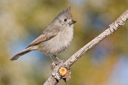
The next morning we headed out to the North Rim in search of optimal light settings…however, it appeared that winter was *NOT* the best time of year for morning sun on the north rim. I quickly dismissed any hopes of scenic photography and decided to just photograph the several Juniper Titmouse that were flying around us:

Juniper Titmouse
Juniper Titmouse

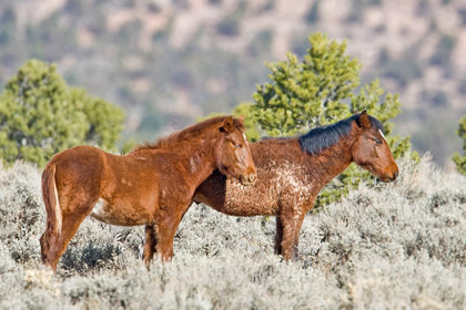
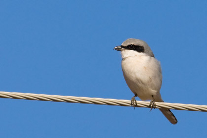
We had a 6 hour drive ahead of us to catch our evening flight out of Phoenix so we started heading back around mid-morning. I opted to drive NW from Canyon De Chelly to Hwy 160 and take that south through Flagstaff and back to Phoenix. We drove many miles of Navajo Nation and through a thin stretch of the Hopi Reservation where Sara noticed some wild Mustang horses out in the field. I was hoping for Northern Shrike as well but all we seemed to notice were Loggerhead Shrikes along the fence lines.

Mustang
Mustang

Loggerhead Shrike
Loggerhead Shrike

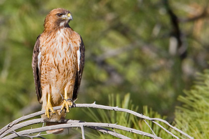
Just north of Flagstaff we took a short detour through Wupatki Natl. Monument where we noticed a stunning adult Red-tailed Hawk at eye-level apparently trying to nab a rodent of some sort just below him:

Red-tailed Hawk
Red-tailed Hawk


Posted by on December 2, 2008 in Photography Adventures

1 Comment

Tags: , , , , , , , , , , , ,